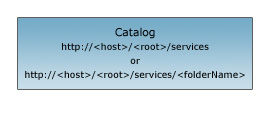
| URL | http://<host>/<instance>/rest/services |
|---|---|
| Child Resources | Map Service Geocode Service GP Service Geometry Service Image Service Network Service Feature Service Geodata Service Globe Service Mobile Service |
Description
The catalog resource is the root node and initial entry point into an ArcGIS Server host. This resource represents a catalog of folders and services published on the host.
The current version of the server is also returned in the response (introduced at 9.3.1). The value of the version is a number such that its value at a future release is guaranteed to be greater than its value at a previous release.
Resource Hierarchy

Parameters
| Parameter | Details |
|---|---|
| f | Description: The response format. The default response format is html. Values: html | json | kmz | sitemap | geositemap
Note: Support for the
The |
| option |
//This parameter was added at 10.1 Description: If option is footprints footprints of all Map, Feature and Image services in that folder is returned as a feature collection. This feature collection can be viewed in a arcgis.com map. This is supported when f=json only.Value: footprints |
| outSR |
//This parameter was added at 10.1 Description: The spatial reference of the geometry returned in footprints. This parameter is supported only when option=footprints is specified.
The spatial reference should be specified as a well-known ID. If outSR
is not specified, the geometry is returned in GCS_WGS_1984. |
Example Usage
Example 1: URL for the root directory on sampleserver1:
http://sampleserver1.arcgisonline.com/arcgis/rest/servicesJSON Response Syntax
Note: The currentVersion property was added to the JSON response at 9.3.1
{
"currentVersion": <currentVersion>,
"folders":["<folderName1>", "<folderName2>"],
"services":[
    {"name" : "<serviceName1>", "type" : "<serviceType1>"},
    {"name" : "<serviceName2>", "type" : "<serviceType2>"}
]
}
JSON Response Syntax (when option=footprints)
{
    "featureCollection": {
        "layers": [
            {
                "layerDefinition": {
                    "type": "Feature Layer",
                    "geometryType": "esriGeometryPoint",
                    "extent": {
                        <envelope>
                    }
                },
                "objectIdField": "id",
                "displayFieldName": "name",
                "drawingInfo": {
                    "renderer": {
                        "type": "simple",
                        "label": <label>,
                        "description": "<description>",
                        "symbol": {
                            "height": <height>,
                            "xoffset": <xoffset>,
                            "yoffset": <yoffset>,
                            "width": <width>,
                            "contentType": "image/png",
                            "type": "esriPMS",
                            "imageData": "<imageData>",
                            "url": "<url>"
                        }
                    }
                },
                "fields": [
                    {
                        "name": "id",
                        "alias": "ID",
                        "type": "esriFieldTypeOID"
                    },
                    {
                        "name": "title",
                        "alias": "Title",
                        "type": "esriFieldTypeString"
                    },
                    {
                        "name": "type",
                        "alias": "Type",
                        "type": "esriFieldTypeString"
                    },
                    {
                        "name": "thumbnail",
                        "alias": "Thumbnail",
                        "type": "esriFieldTypeString"
                    },
                    {
                        "name": "xmin",
                        "alias": "xmin",
                        "type": "esriFieldTypeDouble"
                    },
                    {
                        "name": "ymin",
                        "alias": "ymin",
                        "type": "esriFieldTypeDouble"
                    },
                    {
                        "name": "xmax",
                        "alias": "xmax",
                        "type": "esriFieldTypeDouble"
                    },
                    {
                        "name": "ymax",
                        "alias": "ymax",
                        "type": "esriFieldTypeDouble"
                    },
                    {
                        "name": "link",
                        "alias": "Link",
                        "type": "esriFieldTypeString"
                    },
                    {
                        "name": "arcgisJslink",
                        "alias": "ArcgisJsLink",
                        "type": "esriFieldTypeString"
                    }
                ]
            },
            "featureSet": {
                "geometryType": "esriGeometryPoint",
                "spatialReference": {
                    "wkid": <wkid>
                },
                "features": [
                    {
                        "geometry": {
                            <point>
                        },
                        "attributes": {
                            "id": <id0>,
                            "title": "<title>",
                            "summary": "<summary>",
                            "type": "<serviceType>",
                            "thumbnail": "<thumbnailUrl>",
                            "xmin": <xmin>,
                            "ymin": <ymin>,
                            "xmax": <xmax>,
                            "ymax": <ymax>,
                            "link": "<serviceResource>",
                            "arcgisJslink": "<View In JSAPI link>"
                        }
                    },
                    {
                        "geometry": {
                            <point>
                        },
                        "attributes": {
                            "id": <id1>,
                            "title": "<title>",
                            "summary": "<summary>",
                            "type": "<serviceType>",
                            "thumbnail": "<thumbnailUrl>",
                            "xmin": <xmin>,
                            "ymin": <ymin>,
                            "xmax": <xmax>,
                            "ymax": <ymax>,
                            "link": "<serviceResource>",
                            "arcgisJslink": "<View In JSAPI link>"
                        }
                    },
                    {
                        "geometry": {
                            <point>
                        },
                        "attributes": {
                            "id": <id2>,
                            "title": "<title>",
                            "summary": "<summary>",
                            "type": "<serviceType>",
                            "thumbnail": "<thumbnailUrl>",
                            "xmin": <xmin>,
                            "ymin": <ymin>,
                            "xmax": <xmax>,
                            "ymax": <ymax>,
                            "link": "<serviceResource>",
                            "arcgisJslink": "<View In JSAPI link>"
                        }
                    },
                    {
                        "geometry": {
                            <point>
                        },
                        "attributes": {
                            "id": <id3>,
                            "title": "<title>",
                            "summary": "<summary>",
                            "type": "<serviceType>",
                            "thumbnail": "<thumbnailUrl>",
                            "xmin": <xmin>,
                            "ymin": <ymin>,
                            "xmax": <xmax>,
                            "ymax": <ymax>,
                            "link": "<serviceResource>",
                            "arcgisJslink": "<View In JSAPI link>"
                        }
                    }
                ]
            },
            "popupInfo": {
                "title": "{title}",
                "fieldInfos": [
                    {
                        "fieldName": "id",
                        "label": "ID",
                        "visible": false
                    },
                    {
                        "fieldName": "title",
                        "label": "Title",
                        "visible": true
                    },
                    {
                        "fieldName": "type",
                        "label": "Type",
                        "visible": true
                    },
                    {
                        "fieldName": "thumbnail",
                        "label": "Thumbnail",
                        "visible": false
                    },
                    {
                        "fieldName": "link",
                        "label": "Link",
                        "visible": true
                    }
                ],
                "description": null,
                "showAttachments": false,
                "mediaInfos": [
                    {
                        "type": "image",
                        "value": {
                            "sourceURL": "{thumbnail}",
                            "linkURL": "{arcgisJslink}"
                        }
                    }
                ]
            }
        }
    ]
}
}
JSON Response Example
{
"currentVersion": 9.31,
"folders":["Editing", "USA"],
"services":[
    {"name" : "Anaheim", "type" : "MapServer"},
    {"name" : "Switzerland", "type" : "MapServer"},
    {"name" : "USALocator", "type" : "GeocodeServer"}
]
}
JSON Response Example (when option=footprints)
{
    "featureCollection": {
        "layers": [
            {
                "layerDefinition": {
                    "type": "Feature Layer",
                    "geometryType": "esriGeometryPoint",
                    "extent": {
                        "xmin": -13417361.279435791,
                        "ymin": -3308604.1160364537,
                        "xmax": 13398084.956333593,
                        "ymax": 7344059.61646361,
                        "spatialReference": {
                            "wkid": 102100
                        }
                    },
                    "objectIdField": "id",
                    "displayFieldName": "name",
                    "drawingInfo": {
                        "renderer": {
                            "type": "simple",
                            "label": "Maps",
                            "description": "",
                            "symbol": {
                                "height": 24,
                                "xoffset": 0,
                                "yoffset": 0,
                                "width": 24,
                                "contentType": "image/png",
                                "type": "esriPMS",
                                "imageData": "iVBORw0KGgoAAAANSUhEUgAAADQAAAA0CAYAAADFeBvrAAAABGdBTUEAALGPC/xhBQAAAAlwSFlzAAAOwQAADsEBuJFr7QAAABl0RVh0U29mdHdhcmUAUGFpbnQuTkVUIHYzLjUuMU7nOPkAAAyFSURBVGhD7VlpT5znFY3dpsYsw75vg9lnmBlghmEYhn1YBswAM8CwGHAAE2yIY2zwgoOJwRhju04VN23TRnWcxm6zb06TSm3zsVJVtY1a9UNbJWr7oeoPqJUqSm7PeTyvRKO2yoIHVyrS0bvwLvfcc+95nued++77/9/nz0D/UWv06JJTf2Ct1jq65LCMLVdlPfaTvh2f/4nbdOfAnL1y+KRjafxs9WtjS85fjK9U/3ZixfXrkdOOHw8s2K8On6ps26bQPttrB+cqynvnKm7NXnHL9MU6mb3SIDOXGtT2oceaZP+yS4YXqwCHBI7Zfu4/XN712d4QwqsRZL9/znb78NfccvypNjn2ZKuc+G6bnLrWLotPt8sj32vHfocc+1aLTF2olam1ehlbqhb/bPlGCMP8dK9Cn5S3jJX8XZG45pGlm3tl7ZVuWX2xS1Ze8MoZHJ/5/l5ZutEhp5/xyCK3z+5VBCdXa6nY1U/3phBd1TFufmNyrVZWX+pGwO1y4VaPnH+tW1ZAaO1VbF/yyrmXu+Ts815ZvO6R5ef2Al6o1iFLz3bI2BmnjC07J0MU7n9/TeBYhbExYPyQpXXxLb9s3PLJpbf9INQjK0ESqyBExZZvdiq1zr3cLWeDyi1eb5e5J5ql74j19wsbLRHbTqrvcPlwVUe+6pXLP/IrUpeC2/NQZ/2NHgWlFBR7FMpQndWXupSK3C7d6BT/Q1YZPe1o33ZCPTNlSyZXphy52qwIbbzpUyCxNQS8DqUYOAmtvw5iwf2LwesuQNH113xwvUrxPVR+bNsJBeYrLmYVJ8rIaacixKDPvuhVJFSwb/gUmQvYXqBar4Psm7zOJ+dRhpdRnixHzwNmaR83LW07oZFHHMf1xgQxubJVYFRm5QUYAMqKRrAK8LxSiT2F3uE++2gDJJmEE0+1SuNAsXjGTUe3ndDkmqvG0ZErkfER4t5XIpdAiKTWEbSy6xvATS8Idio7X7wOZ0PPkKjquR/6pG3EKFV4hv9I+d5tJ8QAOqcs7xRXpEm4bpfUDxXLOkrtTrDon1dRgs93KVLLPwAxWDfVUeWJ3umbs4vemMhy+0vPbKnuniCEeVpl85DhtrVJL1EJEWKpy5Lp9TpZQfAMnKCVa/vcHn68SWwtuZKUHSe1/kKBuczeE2S0IPadqpxo3mcUe+seScuNFV1ShOSbkqXWVyB9xypkYqUGxlElXdNlYnPnSGRSpKTiurreAhiC8el7hsz0Rm3E5DmXf+p8zct9c1ZpGiySam+elNVnirkqTYqtyZID08g1JkvanjhJ0sfIHlOiuDpzxY3yBK62jRl33hOEJlaqR5H130wi+xOrLvSDFQpYBD0lzfsM0goEjtw55wZRDxT0jJvF+6BFAnPWDwLztuZ7gggWal8ZWay8hvWNPHyVS4UGwRoHo32ZCt4zViKe/SUgZpbe2VJFyjdTxj4RLBkUBo/bP0QStr9vjn3Tff/AvP3tnlmrWuMcwTxs/7JTqcOASaj9gRLpmDRJ5wEzlcASgWRKOV8T/8Pl0nWoVIZPVkpg3i6Yqd+YuVIftm1KjSw6vtM6ZpLxlVpMd1owZbHLwHyFIqIIoZw6xk04Nkv3QYsMgFAfSWAfizrpx7FvtlztY2kuAwuVJHVzWwhNPOoaZn+0oQ+OfqNF9mH1SWW6kX3PeIlSoAfZ7xgzglQJygxKzNtkENDKjdd0HyyV3sM2GT/rkqnzdSopMJeFkJLix43+OdvP6vuKJXDcIYvPdCBo8x0jQIDuwWKlEpVg76j+AaGRTb2lFAThtlEjklCGFatTZq40QqFqlt8HmAJlhowUHK0QAX9gb8+Xg5eb5BSW1fa2PSpw9oWzMw/zsSLxQkEq03PIgt5hr9hVD5FsL9SBRYsTtt6JY35fYNk9eKFevNOlAvs/EzJCwyfsvR40u7UlD98FWtVKs9CaokhRoYrWHLE265Vds+x8IMNSG11E80PFwFGbImXDNSTEfarLkpt7okXaJ9FvC/Z3QkZocME+04SyKm3Qy5Gvu9VHj7zSZMkojMcgmqWMoNZfAII50oqSYsCji3YZX65SNs1kkLTJlaH6TY1NGFgnMX7NXG6QpiGDdByw/C2khBr6i6SsIZuuBFNoFmtTtujiwiUpI1oM9jTVG83DBmkIFEl9X6E0I2CNqNWtV+fYR2NnqtR1tuYcObhRK7OPuaXGXyRt+0tCR6j/qK3P1ZUnBke6GjRnvlqv3I3ztmhMSCNBLCEjSnLLksXWqpfRhXKZOVeleobKYq3DgBVpV0++FFWkYoqUq9QePOmQGh8IjRnfC5lCwwt2Cwh9nFkUr8rG/zDqf71WlVdSlk4iY8IkMna36OLDJRGKNfXkSGDGJC5foVjqcyTfmi45JcmShfsz8uMlPT8OE9ZqWfh2q7j8xVK1N0/cw8bfhYwQXwRlfpVTkihpCIZLBCy/5dDlOjiUBcEmKDK6hHCJS44EoiQlO1ZyLSmSiSV6YlY0iOpAPlrS8mJVrx1GqXmnrWJ0ZYmru0AaA0XvhpQQvlFP0QBScmIkIU0HU0gRN1abAwsV0gKl6HqJmToEHoW+0kl8KvejJR7HBAml5seKsSpd6gMYtw5a0ZN6Mddkqv7C2PRcSAlhcN3pnTa/lY8lAdWIQJnpsPROyY6RQluqCqwY5pBjTlSllW1IhHJJWD5gC+SjvwrLUqSgPFXKGmnzdL1MccHG2Wsnr3lCNvvWfgLZwZ9EOibN7/PDSDgIhevCJCx8l4RF7JKYRJCDelz3ZBaQENZB5mS15TGRBoW4sNsDYrkgZkISnPiesP+M83qo1CEZgouwLwFfHjxRUYRvAO8aUDp0OH5LCI++Q47GEBEDc4DrRcagp7BVvQUldYmRKMkYSdHHwhTi4XRp6uPI8HH7T09da4sKBaF/IYIXfgXgVD/cUqdPx+D4VA0sONeSKNHJERKXEomvP7slLDJMdoNUUiYMIOhoXKnGoZ+SUJ5pBXFidKKPeguxjrI/P/9kc8zdJKMpwq1SBNgF7AYiAX6ZiQUSgCQENYCR/+16fOjgQGttyJDqtiyx1aWjn1IlH2WVaUAfmVKkEGNPGdyxvp8GUPpHLCGmg8pr77wrvDarcn9QERKJBuKBZCANyAL2AHlAfm5JggcD5dWuB823p1acMvGI/SPfIcttfHP7iDOMlhHjP3pny/4MVV8Hpkyu9KSg4kwYE3dXfqr8JBmqwtqOCxLJwDaHBAADYAJKgXLACrQWFBj/UNfofq+vb+gVQ6HB63A4hvYPjQz1+/o7s7KyeE9qMDFUOhyg+kzcXSGlNb6mDMlQFQahBwqAEqAMsANVgAuoBeqQjXOOSodUO6vFUGBYDv6f15EwyRcBVDUdSARiAP6EQlJUiu/fMqU0dTaXGZXRyDCY0iARkmgA3EArwB+BPTt37LwVGRElGenZH4fvCj+Ac03B63h9ZTARVCkXoNokpSlFw6FKW0Jqc6nxwSwFZo/9wl6hMpZgUFSDREiC36K9AH/8Hdhx3473oyKjxGKx/DV4nv/3ABww6wEnQLVIikqxF5k09qhWeltKSHM0voAv4guZTSNgA2qCZBhkJ9AN+IBeYAT4ky5KJyUlpl9i3w/0BIl1YNsSJOXAthRgkpgsmsMnVfrCZadZ9ObeoS2zLGgAZoC9QHUYGAOkKhqZPuz3A6eBx4HjAM9tJsUksARZfjSQYkAPpAAcBthLWtl9IRvXbmb9khCdjRljff8nQvzpkKVGBRg0gyfmg2QCn4IQy46OyR7VCG2ZOWgKMUMaISpEN2LJ0dlYctVAI0AjoEok1R0kRrVmgIkgSR7zf7yG1/IeGgmdkS757xTackKbS449xHLQA3Q4mkIFoDkcG53GQLXY/OwpKkPFSILHJMJSY5mSDBPCZ9DCWcr8bMUe4qBNI9rSkqO7aKbAeo4BWHZUiY7EjGqk6FY0iHqAfUHXY9AElSC4z/Mkwt7jPVSZ/cgE6QGWGxPH8Y6VsSUDrNZDGiGt7PgS1jYzqM0QCrGvDawMjmMLA6VqJEgweIL7VISuRlVYZryX7sbeoYOyrDV1trTcNhuDphJLYDMpBpANsKdITJv6UDUGq01/SJQuxmOepyK0fd7De2nVGpkY7HOI4Ax+szpbYtufnMcxYxopvpjZ5EDLEmRQzDIDZC8wWJYRy1IDj6kGJ6+8ViPCZ3A6RWU0MqyKzVOfL0wIz1NzKI0UH86MbV42MADWu0aM9U9yLEc2NwOmggT3CZ6nGjQXli6JxABUnsnSlNlyMiT0P/n3TwJZjWQIaMQeAAAAAElFTkSuQmCC",
                                "url": "http://sampleserver/arcgis/rest/static/images/GreenShinyPin.png"
                            }
                        }
                    },
                    "fields": [
                        {
                            "name": "id",
                            "alias": "ID",
                            "type": "esriFieldTypeOID"
                        },
                        {
                            "name": "title",
                            "alias": "Title",
                            "type": "esriFieldTypeString"
                        },
                        {
                            "name": "type",
                            "alias": "Type",
                            "type": "esriFieldTypeString"
                        },
                        {
                            "name": "thumbnail",
                            "alias": "Thumbnail",
                            "type": "esriFieldTypeString"
                        },
                        {
                            "name": "link",
                            "alias": "Link",
                            "type": "esriFieldTypeString"
                        },
                        {
                            "name": "arcgisJslink",
                            "alias": "ArcgisDotComLink",
                            "type": "esriFieldTypeString"
                        }
                    ]
                },
                "featureSet": {
                    "geometryType": "esriGeometryPoint",
                    "spatialReference": {
                        "wkid": 102100
                    },
                    "features": [
                        {
                            "geometry": {
                                "x": -4110976.4722963073,
                                "y": -1200585.1408432242
                            },
                            "attributes": {
                                "id": 0,
                                "title": "Maps/Brazil",
                                "type": "MapServer",
                                "thumbnail": "http://sampleserver/arcgis/rest/services/Maps/Brazil/MapServer/info/thumbnail",
                                "xmin": -4254455.8606807785,
                                "ymin": -1273247.593581636,
                                "xmax": -3967497.083911836,
                                "ymax": -1127922.6881048125,
                                "link": "http://sampleserver/arcgis/rest/services/Maps/Brazil/MapServer",
                                "arcgisJslink": "http://www.arcgis.com/home/webmap/viewer.html?url=http%3A%2F%2Fsampleserver%2Farcgis%2Frest%2Fservices%2FMaps%2FBrazil%2FMapServer&source=sd"
                            }
                        },
                        {
                            "geometry": {
                                "x": -13275825.10565813,
                                "y": 4497582.1039284635
                            },
                            "attributes": {
                                "id": 1,
                                "title": "Maps/CaliforniaDEM",
                                "type": "ImageServer",
                                "thumbnail": "http://sampleserver/arcgis/rest/services/Maps/CaliforniaDEM/ImageServer/info/thumbnail",
								"xmin": -4254455.8606807785,
                                "ymin": -1273247.593581636,
                                "xmax": -3967497.083911836,
                                "ymax": -1127922.6881048125,
                                "link": "http://sampleserver/arcgis/rest/services/Maps/CaliforniaDEM/ImageServer",
                                "arcgisJslink": "http://www.arcgis.com/home/webmap/viewer.html?url=http%3A%2F%2Fsampleserver%2Farcgis%2Frest%2Fservices%2FMaps%2FCaliforniaDEM%2FImageServer&source=sd"
                            }
                        },
                        {
                            "geometry": {
                                "x": -13569208.159400005,
                                "y": 5676326.031612823
                            },
                            "attributes": {
                                "id": 2,
                                "title": "Maps/CascadeLandsat",
                                "type": "ImageServer",
                                "thumbnail": "http://sampleserver/arcgis/rest/services/Maps/CascadeLandsat/ImageServer/info/thumbnail",
								"xmin": -4254455.8606807785,
                                "ymin": -1273247.593581636,
                                "xmax": -3967497.083911836,
                                "ymax": -1127922.6881048125,
                                "link": "http://sampleserver/arcgis/rest/services/Maps/CascadeLandsat/ImageServer",
                                "arcgisJslink": "http://www.arcgis.com/home/webmap/viewer.html?url=http%3A%2F%2Fsampleserver%2Farcgis%2Frest%2Fservices%2FMaps%2FCascadeLandsat%2FImageServer&source=sd"
                            }
                        }
                    ]
                },
                "popupInfo": {
                    "title": "{title} ({type})",
                    "fieldInfos": [
                        {
                            "fieldName": "id",
                            "label": "ID",
                            "visible": false
                        },
                        {
                            "fieldName": "title",
                            "label": "Title",
                            "visible": true
                        },
                        {
                            "fieldName": "type",
                            "label": "Type",
                            "visible": true
                        },
                        {
                            "fieldName": "thumbnail",
                            "label": "Thumbnail",
                            "visible": false
                        },
                        {
                            "fieldName": "link",
                            "label": "Link",
                            "visible": true
                        }
                    ],
                    "description": null,
                    "showAttachments": false,
                    "mediaInfos": [
                        {
                            "type": "image",
                            "value": {
                                "sourceURL": "{thumbnail}",
                                "linkURL": "{arcgisJslink}"
                            }
                        }
                    ]
                }
            }
        ]
    }
}