| URL | http://<catalog-url>/<serviceName>/FeatureServer |
|---|---|
| Supported Operations | Query Apply Edits Create Replica Synchronize Replica Unregister Replica | Parent Resource | Catalog |
| Child Resources | Layer Uploads |
Description
Feature services allow you to serve features over the Internet and provide the symbology to use when displaying the features. Features are organized into layers on which clients can execute queries and perform edits. Feature services provide templates which can be used for an enhanced editing experience on the client. Data from relationships and non-spatial tables can also be queried and edited using feature services
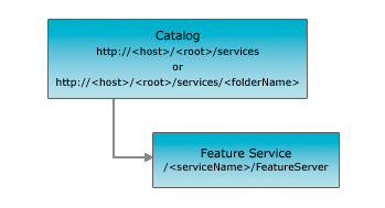
The REST API feature service resource represents a feature service published with ArcGIS Server. This resource provides basic information about the feature service including the feature layers and tables that it contains, the service description, etc.
New in 10.1
The property hasVersionedData will be true if the data is versioned.
The property supportsDisconnectedEditing will be true to indicate the support for disconnected editing.
The property supportedQueryFormats returns the formats in which query results can be returned.
The property maxRecordCount returns the maximum number of records that will be returned at once for a query.
The property capabilities now returns additional Create, Delete, Update and Uploads capabilities. Uploads capabilities will be included if Create, Delete or Update is enabled for a Feature Service. Editing capability will be included if Create, Delete, Update is enabled and allowGeometryUpdates is true
The property allowGeometryUpdates returns true if the geometry of the features in the layer can be edited.
The properties zDefault and enableZDefaults are returned for a service configured with default Z values.
Feature Service resource has new input parameters option and outSR to support viewing of a feature service footprint in arcgis.com.
Resource Hierarchy
Parameters
| Parameter | Details |
|---|---|
| f | Description: The
response format. The default response format is html. Values: html | json |
| option |
//This parameter was added at 10.1 Description: If option is footprints the footprint of the feature service is returned as a feature collection. This feature collection can be viewed in a arcgis.com map. This is supported when f=json only.Value: footprints |
| outSR |
//This parameter was added at 10.1 Description: The spatial reference of the geometry returned in footprints. This parameter is supported only when option=footprints is specified.
The spatial reference should be specified as a well-known ID. If outSR
is not specified, the geometry is returned in GCS_WGS_1984. |
Example Usage
Example 1: URL for the "311Incidents" feature service on sampleserver3.
http://sampleserver3.arcgisonline.com/ArcGIS/rest/services/SanFrancisco/311Incidents/FeatureServer?f=pjsonJSON Response Syntax
{
  "currentVersion": <currentVersion>, //Added at 10.1
  "serviceDescription": "<serviceDescription>",
  "hasVersionedData": <true | false>, //Added at 10.1
  "supportsDisconnectedEditing": <true | false>, //Added at 10.1
  "supportedQueryFormats": "<supportedQueryFormats>", //Added at 10.1
  "maxRecordCount": "<maxRecordCount>", //Added at 10.1
  "capabilities": "<capabilities>", //Added at 10.1
  "description": "<description>", //Added at 10.1
  "copyrightText": "<copyrightText>", //Added at 10.1
  "spatialReference": {<spatialReference>}, //Added at 10.1
  "initialExtent": {<envelope>}, //Added at 10.1
  "fullExtent": {<envelope>}, //Added at 10.1
  "allowGeometryUpdates": <true | false>, //Added at 10.1
  "units": "<units>", //Added at 10.1
  "documentInfo": { //Added at 10.1
   "<key1>": "<value1>",
   "<key2>": "<value2>"
   },
  //the feature layers published by this service
  "layers": [
    { "id": <layerId1>, "name": "<layerName1>" },
    { "id": <layerId2>, "name": "<layerName2>" }
  ],
  //the non-spatial tables published by this service
  "tables": [
    { "id": <tableId1>, "name": "<tableName1>" },
    { "id": <tableId2>, "name": "<tableName2>" }
  ]
  "enableZDefaults": <true | false>,//Added at 10.1
  "zDefault": <zDefaultValue>,//Added at 10.1
}
JSON Response Example
{
  "currentVersion": 10.1,
  "serviceDescription": "Edit parcels, buildings and owner information.",
  "hasVersionedData": false,
  "supportsDisconnectedEditing": true,
  "supportedQueryFormats": "JSON, AMF",
  "maxRecordCount": 1000,
  "capabilities": "Create,Delete,Query,Update,Editing",
  "description": "Street Map USA",
  "copyrightText": "ESRI",
  "spatialReference": {
   "wkid": 4326,
   "latestWkid": 4326
  },
  "initialExtent": {
   "xmin": -109.55,
   "ymin": 25.76,
   "xmax": -86.39,
   "ymax": 49.94,
   "spatialReference": {
    "wkid": 4326,
    "latestWkid": 4326
   }
  },
  "fullExtent": {
   "xmin": -130,
   "ymin": 24,
   "xmax": -65,
   "ymax": 50,
   "spatialReference": {
    "wkid": 4326,
    "latestWkid": 4326
   }
  },
  "allowGeometryUpdates": true,
  "units": "esriDecimalDegrees",
  "documentInfo": {
   "Title": "StreetMap USA",
   "Author": "ESRI Data Team",
   "Comments": "ESRI Data and Maps",
   "Subject": "Street level data for the US",
   "Category": "vector",
   "Keywords": "StreetMap USA"
  },
  "layers": [
    { "id": 0, "name": "Parcels" },
    { "id": 1, "name": "Buildings" }
  ],
  "tables": [
    { "id": 2, "name": "Owners" }
  ]
  "enableZDefaults": false
}
Example 2: When requesting footprint for a service:
URL: http://sampleserver.arcgisonline.com/arcgis/rest/services/SanFrancisco/311Incidents/FeatureServer?f=json&option=footprints&outSR=102100
JSON Response Syntax
{
"featureCollection": {
"layers": [
{
"layerDefinition": {
"type": "Feature Layer",
"geometryType": "esriGeometryPoint",
"extent": {
<envelope>
},
"objectIdField": "id",
"displayFieldName": "<displayFieldName>",
"drawingInfo": {
"renderer": {
"type": "simple",
"label": "<label>",
"description": "",
"symbol": {
"height": 24,
"xoffset": 0,
"yoffset": 0,
"width": 24,
"contentType": "image/png",
"type": "esriPMS",
"imageData": "<imageData>",
"url": "<imageUrl>"
}
}
},
"fields": [
{
"name": "id",
"alias": "ID",
"type": "esriFieldTypeOID"
},
{
"name": "title",
"alias": "Title",
"type": "esriFieldTypeString"
},
{
"name": "summary",
"alias": "Summary",
"type": "esriFieldTypeString"
},
{
"name": "description",
"alias": "Description",
"type": "esriFieldTypeString"
},
{
"name": "tags",
"alias": "Tags",
"type": "esriFieldTypeString"
},
{
"name": "type",
"alias": "Type",
"type": "esriFieldTypeString"
},
{
"name": "thumbnail",
"alias": "Thumbnail",
"type": "esriFieldTypeString"
},
{
"name": "xmin",
"alias": "xmin",
"type": "esriFieldTypeDouble"
},
{
"name": "ymin",
"alias": "ymin",
"type": "esriFieldTypeDouble"
},
{
"name": "xmax",
"alias": "xmax",
"type": "esriFieldTypeDouble"
},
{
"name": "ymax",
"alias": "ymax",
"type": "esriFieldTypeDouble"
},
{
"name": "accessInformation",
"alias": "Access Information",
"type": "esriFieldTypeString"
},
{
"name": "licenseInfo",
"alias": "License Information",
"type": "esriFieldTypeString"
},
{
"name": "credits",
"alias": "Credits",
"type": "esriFieldTypeString"
},
{
"name": "link",
"alias": "Link",
"type": "esriFieldTypeString"
},
{
"name": "arcgisJslink",
"alias": "ArcgisJsLink",
"type": "esriFieldTypeString"
}
]
},
"featureSet": {
"geometryType": "esriGeometryPoint",
"spatialReference": {
"wkid": <wkid>
},
"features": [
{
"geometry": {
<point>
},
"attributes": {
"id": 1,
"title": "<title>",
"summary": "<summary>",
"description": "<description>",
"tags": "[\"<tag1>\,\"<tag2>\"]",
"type": "MapServer",
"thumbnail": "<thumbnailUrl>",
"xmin": <xmin>,
"ymin": <ymin>,
"xmax": <xmax>,
"ymax": <ymax>,
"accessInformation": "<accessInformation>",
"licenseInfo": "<licenseInfo>",
"credits": "<credits>",
"link": "<serviceResourceLink>",
"arcgisJslink": "<View in JSAPI Link>"
}
}
]
},
"popupInfo": {
"title": "{title} ({type})",
"fieldInfos": [
{
"fieldName": "id",
"label": "ID",
"visible": false
},
{
"fieldName": "title",
"label": "Title",
"visible": true
},
{
"fieldName": "summary",
"label": "Summary",
"visible": true
},
{
"fieldName": "description",
"label": "Description",
"visible": true
},
{
"fieldName": "tags",
"label": "Tags",
"visible": true
},
{
"fieldName": "type",
"label": "Type",
"visible": true
},
{
"fieldName": "thumbnail",
"label": "Thumbnail",
"visible": false
},
{
"fieldName": "xmin",
"label": "xmin",
"format": {
"places": 2,
"digitSeparator": false
},
"visible": false
},
{
"fieldName": "ymin",
"label": "ymin",
"format": {
"places": 2,
"digitSeparator": false
},
"visible": false
},
{
"fieldName": "xmax",
"label": "xmax",
"format": {
"places": 2,
"digitSeparator": false
},
"visible": false
},
{
"fieldName": "ymax",
"label": "ymax",
"format": {
"places": 2,
"digitSeparator": false
},
"visible": false
},
{
"fieldName": "accessInformation",
"label": "Access Information",
"visible": true
},
{
"fieldName": "licenseInfo",
"label": "License Information",
"visible": true
},
{
"fieldName": "credits",
"label": "Credits",
"visible": true
},
{
"fieldName": "link",
"label": "Link",
"visible": true
}
],
"description": null,
"showAttachments": false,
"mediaInfos": [
{
"type": "image",
"caption": "Initial Extent: [{xmin}, {ymin}] - [{xmax}, {ymax}]",
"value": {
"sourceURL": "{thumbnail}",
"linkURL": "{arcgisJslink}"
}
}
]
}
}
]
}
}
JSON Response Example
{
"featureCollection": {
"layers": [
{
"layerDefinition": {
"type": "Feature Layer",
"geometryType": "esriGeometryPoint",
"extent": {
"xmin": -11837496.295089964,
"ymin": -2567294.2415802763,
"xmax": 211652.80320823845,
"ymax": 5592472.077952366,
"spatialReference": {
"wkid": 102100,
"latestWkid": 3857
}
},
"objectIdField": "id",
"displayFieldName": "Hurricanes_msdFeatureServer",
"drawingInfo": {
"renderer": {
"type": "simple",
"label": "Hurricanes_msd",
"description": "",
"symbol": {
"height": 24,
"xoffset": 0,
"yoffset": 0,
"width": 24,
"contentType": "image/png",
"type": "esriPMS",
"imageData": "iVBORw0KGgoAAAANSUhEUgAAADQAAAA0CAYAAADFeBvrAAAABGdBTUEAALGPC/xhBQAAAAlwSFlzAAAOwQAADsEBuJFr7QAAABl0RVh0U29mdHdhcmUAUGFpbnQuTkVUIHYzLjUuMU7nOPkAAA2gSURBVGhD7VkJUFVnmo3p6WWMCxFREzdwQYIoCsoiKhpFFBUXFAyi6FMRBGVHBVlkE1kENAqCGpYoalQioiGko22mo+0SjUtnOt2JWbq7bJNOTCrGtqurc/qcK7eKSc1MpTsEnKqh6tS973Lfu9/5z/nO///vPfbY///96yOQFVfevTj1mG1FbpNrSWqdc2n6oQG/Pf1Np3/9Ezvonbmx1e75Gw6k7sw8frw09cjlXVnHb5ZlNb5dlHLw57mJVTsKNu6f3kGl/XOP3RK71yUjdm/j/uIL2FfwGl4sPovawjeM44GSc9ie3oiC5MPIT65DTvyei+nrds35557QjncXJB8MTI+tvF9XegmNe/8T9RXXceqFd/Bq1Xtorn4Pr7/4Ps8/RP3uq6jc2ozK3DMoTT2OtKidW9uxzO/2qJLUIy6RoZlf11fcxKmq3+BM3Ue4+PLnOH/0E5w7chu/4OtfHPwYZw58gJ/XvotmHfd/RIK3sDu7mYod3PHdntROd8VZ8k+U5zbh/LHPWPDvcPXkl7jccBfnSOjS8c9w7tgdXKj/FG++dAfNNe/i7OHf443Dt6nahzi9/0OUph1BafqRle1U7v/+mOz4F4avDNr8t6aq93Gj6T6unfwKN1/9Cwl9gXMk8cuXbuNXJHSJip2t+wPV+pjkPsObR+4Y58017+PIrsvIjCn/bUP+1Sc6nNTmdbsWB81chyb2yq+bHxikbvJ4ncfLx+/iSuOXBi7xXIr9B5V54/CfqOanhornj31CK/4RaWvLUJJS59fhhFIiS1Onjl+Il56/bBC6duqeARG61PA53qJSKlzWe+vEF7ym87u4fupr476rJ+/xnq+RHV+L1LU74zucUE7C3vyRz0xEUcoRg9BbJ77Em0fvkMTnRrFXGr8yCFzl8arUOvEVydzn8R4uv3wXv371Ae34GaKXb0WsJSe1wwlt21SXNHq4F6aOD2Gy3aXlHjDZPsEvaa0L9X/GefbRRRZsqMTX6h2dq4+ukaQG4dTeG1i1KBkxlpy4Die0O7dhQuDM1ehhbYfwkGzcpNVuNP2FNrr7MK4PEHW3SfCPRpw319xiz/yBRP/8sOdeuYe1S9IRNDMCaTE7Z3U4IRWQFFZ4xnvsLHTv1guW4BRcodVU7PVXGN/Hv2Bcf2qQeuMQiTH1pI5hz4Z7yIytwujh3rLb7zdFlXR7JAiVZZ1wjwhOvT97ylL07GkHX+9g7Mt7Dec476hw4SZ7xTzXsW7HrzBnWjjsBrojNCABDJeoR4KMWUThxtoVESHpCPANg8NgV/TqNQieI3wQOj8OmfF7UZZ1CttSDmFDeCnmTl0B615DYT/YBcsWxDEQNlc9MmT25Tc9UZ7TGFC55dSxzNhyhD23AcH+kfCbFIRpnv6Y6OoDF4aG2/ApGDbIDYNsnTFmhDcWz45AeHAykbJjbWj6448EobKs+qUc9RvlWSdRlt3IfijHxvBCJIUVICIkDVEhqciJeXht9XPrEU0FYyx5WL+6ANmxux/kJFT4PBJEuFH7SVHy/heKUupw6HltFc6CexzO9tuN4qNDMxG9LIvEtiIjqgTZJJUauR2bCG4ZiJ3YklT1t7Lsho7vm/rySz/OTahpSokq5x7nPA5zHbY94xjV2c2CS9kjBYhdnoX4lTlIWpVHJcqRHlXK/5VovYb06F3YuKYY+RtqkZNQDa7U99cWn/5Zhym1LflAZVRoLnZlNXG58zY3alXITdhHIoUGoY2rCxFvyaFS+UiOKERubBkyo3diY0SRNnXIIvHUqOe51KlERW4zchNrRepAhxAq29ywODGsCOss+Thadg2F3H1KmWSOfowlG5tjypCyZhviQtNJKps224aChD3YQois7LaZKiVHFCNjXQV2ZZ5A5ZbXSa4a+/KbE9uVlL7cyIqtOG9ZuBE5SXVorr2FOMvWh0EQsY1Nn2yoJCWSwvIf9g+JFm2sNXpL/+NcQ7ttw9qlGRyE7dyxHkVt8ZsoTq2X/R6c3Hu9f7uRYqIN2xBe9GC+31pUFZ3Hq9xWz5++EoksXn2xaPYarsc2YD0TLpVENq0pZO9QoQ1V3GY/DIsMKrg2NAPPMdYTw4v4/cIhw3Z7t57G+vASlOecSGs3QgXraxbELM+G/7RIfi9wnTvNW/BynYaA6WGGQvN8LZjts9SI601s+tSoYuQlVKA4eb8iGtlxlYZKc32WYREJcXCwmdcrt7zGDd7biF1ZxH6qPtNuhPISqyPDaKsZk0NxeOcF40sP91E+cBzmyUk02AiC0IAYqmZBFC2ltCtOrsHOjENIY0xHM/nm+S7nqjzA6DeR46SKcs5ftUVnERachvhVBXfaldCKwCT4TQ6h548yFC5j9pQQ2PToD7t+TpjkNou9kY6IxalYEZQEy8J4RLDgOINoHGZPXcZrCUY4lKYd4n1pVGs5qvKb8WLJBSwJSMLaZZntRygrrnLh4jlRmOQxh5NmNmq3nWFjF2MY12O9e9rCmsQG9nOA2+ipmOsbiuLE51Gbc4g9k87lkLHXwbplmQbpkHnRmDB2JpdIEXhp50XkbTiIJfNJKDTjVrspVJBY7UxC3zg5eNA2C5AWXYY9eU20VzrsBjiih9VTsH6yL2ys+8O23wiEzbMgJzIXi+fHw3fScni6zoWL01SMdPCE41APPDPUjQvWl9FQeQMhAckImhWF8MXp77QbIT0oelnmVReniRg21B3TuUXg9hs1Ra8zoQpZ7ASSGQibngPRt/cQwh5DBrpirLMvnJ7xhu2AESTqSPJOcBjiavRaXclFvrcMk8cvQsjcGKwKWn+tXQntyno5TAEw1M4ZA54ezlCYhnDuNnMT9yGSSnm5+sK2vyMLH8a+Go7+T+ncCf1pRUGE7Ie6YrLnHFiCkpmOZezJUEybsJD9lUgLlx5qV0KcXB9fH57/ige3BLLWk1Z9eLSlEs7wGjODhQXC280friO9DWuNcpxI5Z7l9sHbgCf7y2v0NIxzmQm/Zy3w91kBn/GBWMwY1/z0StW77bb6Nn8C6aSfROJX5n0wevgEdGffdO/WB10626DLE73Qx8aO6o0y9j1O9h4k5IWxI6fAmUcn+3EGHKiQ/eAxGDN6OtxcZsCH6iyaGY7taUer20sdkRG0CfsR8W956/c5xFpyr02idXpzy63vEqy694FVt6fQg8HwpFU/xvlAWFv1N2JdatpYD4KNzRBa0hlDbMcwFMYx6Wbxy5Fw5CdVn26qeqdrexD6L0T4wJ8QWup3nu69tC9n+z1LGMFuzpPQu7cd+vYZDGvrfujSpQ+6Wj0Nu/4jqYgSzZ071VHox/SzGzgaDvbumDxuHiwLEriPqjl8vOKK1Q9JxlRER0MR4qfEvxNdCH0z8yTRk+i1fEH8Is78TZaAePhzovWfPB/B0xdhrvc8THTzg6eLH5wc2UcjfOE11g9+TEdLYILmsPe4hQhvUd585g/Cq7UqP25RRES6E9ZEb+JpYgAxiBhCDB3r5DWDE+WOjau33t+TdQRlm2r+nrqm6P66Jel/XxG4HpFLMv6aEbXjYy55GqhsmM/4eb1aFNeAaeB+kJ8qv01GqsjbPVqI9OPRTgQIR2IEMYpwIVwJX3v74b/zfnbqrYULg+sdhzn6e3h4BC8LXhIcOD9w9oABA/Sep1oGRkp3JqS+Bu4HIWU2vqmMyEgVFWFL2BNOxGjCjfAkxhMTCW+ORraHuwe8xnnB0d4xveX/uk+ERd6BkKp9CRvCitBPKCIlpfT8NlPKVKe1zaSMSUbFjGohIhKTiamEL6EfgWc83unxxi5PdEW/vgO/6fzTzqt4bUrLfbrfvWUgpNJgQmqLlKmUAkcqtQmp1lbTB8sKGj31i3pFyji3FCU1REQk9F20P6Effxd1eqzTB127dIWzs/Ptluv6/wxCE+YkYhwhtURKSqkXNWjqUdN6bUrITDQ9QA/SAzWaw4kxxIQWMipyNjGXmE8sIJYQH3Xr2g1OTiOu8DyAmNdCbCaP01pIefA4itAgabAUDt9W6Xvbzozo1r2jWJYtFAAjCfWC1FFhKlCqmGQW8jyQSCG2E0mErrUmpUGQBWU/BcgzhC3Rh9A0oF4ybfe9Ytx8s/wrQko2jZj8/T8R0k+HspoUUNEqXkhoIRP0HQjJdkpM9ahJqM3CwVRII2QSkkJKI1lOySbLeRHPEgoCqSRSc1uISa1IYkULSb3W/3SP7tV7FCRKRqXkf6dQmxNqbTn1kOxgSyjhFApjCTPh1OgKBqml5ldPSRkpJhJ6LSKymmwqMhoQfYYiXFbW11bqIU3aCqI2tZzSxQwF+dmKkO2kkhJJI2qSUlopICYR6gulnooWpISgc10XEfWe3iOV1Y8aIFtCdtPAab6TM9pkgjV7yCRk2k4Pkbc1guYKYRjPzYlVxWluUaFSTQQFFS/oXIoo1aSKbKb3Kt3UO0pQ2dpUp03t1joYTJVkgdakVMBAQj0lYubSR6qpWHP5I6JKMb3WdSmi2Nd79F5FtUnGiueaIrSCb61Om8T2t9dxGjGTlB6s0dREKwuqKI2yClQvqFjZSLY0oddSQ4tX3WsS0WdoOSVlTDJyReulz/cmxM8z1lAmKX24Rqz1tkEFyO8mMflf5GRHNbcKloKCzgVdlxoKF1lXRKwIKa/BMpVpczIi9H/y7x8HRRVlwh1ZewAAAABJRU5ErkJggg==",
"url": "http://sampleserver/arcgis/rest/static/images/PurpleShinyPin.png"
}
}
},
"fields": [
{
"name": "id",
"alias": "ID",
"type": "esriFieldTypeOID"
},
{
"name": "title",
"alias": "Title",
"type": "esriFieldTypeString"
},
{
"name": "summary",
"alias": "Summary",
"type": "esriFieldTypeString"
},
{
"name": "description",
"alias": "Description",
"type": "esriFieldTypeString"
},
{
"name": "tags",
"alias": "Tags",
"type": "esriFieldTypeString"
},
{
"name": "type",
"alias": "Type",
"type": "esriFieldTypeString"
},
{
"name": "thumbnail",
"alias": "Thumbnail",
"type": "esriFieldTypeString"
},
{
"name": "xmin",
"alias": "xmin",
"type": "esriFieldTypeDouble"
},
{
"name": "ymin",
"alias": "ymin",
"type": "esriFieldTypeDouble"
},
{
"name": "xmax",
"alias": "xmax",
"type": "esriFieldTypeDouble"
},
{
"name": "ymax",
"alias": "ymax",
"type": "esriFieldTypeDouble"
},
{
"name": "accessInformation",
"alias": "Access Information",
"type": "esriFieldTypeString"
},
{
"name": "licenseInfo",
"alias": "License Information",
"type": "esriFieldTypeString"
},
{
"name": "credits",
"alias": "Credits",
"type": "esriFieldTypeString"
},
{
"name": "link",
"alias": "Link",
"type": "esriFieldTypeString"
},
{
"name": "arcgisJslink",
"alias": "ArcgisJsLink",
"type": "esriFieldTypeString"
}
]
},
"featureSet": {
"geometryType": "esriGeometryPoint",
"spatialReference": {
"wkid": 102100
},
"features": [
{
"geometry": {
"x": -5812921.745940862,
"y": 1512588.918186045
},
"attributes": {
"id": 1,
"title": "Hurricanes",
"summary": "",
"description": "",
"tags": "[\"hurricanes\",\"2000\"]",
"type": "FeatureServer",
"thumbnail": "http://sampleserver/arcgis/rest/services/Hurricanes_msd/FeatureServer/info/thumbnail",
"xmin": -11837496.295089964,
"ymin": -2567294.2415802763,
"xmax": 211652.80320823845,
"ymax": 5592472.077952366,
"accessInformation": "",
"licenseInfo": "",
"credits": "",
"link": "http://sampleserver/arcgis/rest/services/Hurricanes_msd/FeatureServer",
"arcgisJslink": ""
}
}
]
},
"popupInfo": {
"title": "{title} ({type})",
"fieldInfos": [
{
"fieldName": "id",
"label": "ID",
"visible": false
},
{
"fieldName": "title",
"label": "Title",
"visible": true
},
{
"fieldName": "summary",
"label": "Summary",
"visible": true
},
{
"fieldName": "description",
"label": "Description",
"visible": true
},
{
"fieldName": "tags",
"label": "Tags",
"visible": true
},
{
"fieldName": "type",
"label": "Type",
"visible": true
},
{
"fieldName": "thumbnail",
"label": "Thumbnail",
"visible": false
},
{
"fieldName": "xmin",
"label": "xmin",
"format": {
"places": 2,
"digitSeparator": false
},
"visible": false
},
{
"fieldName": "ymin",
"label": "ymin",
"format": {
"places": 2,
"digitSeparator": false
},
"visible": false
},
{
"fieldName": "xmax",
"label": "xmax",
"format": {
"places": 2,
"digitSeparator": false
},
"visible": false
},
{
"fieldName": "ymax",
"label": "ymax",
"format": {
"places": 2,
"digitSeparator": false
},
"visible": false
},
{
"fieldName": "accessInformation",
"label": "Access Information",
"visible": true
},
{
"fieldName": "licenseInfo",
"label": "License Information",
"visible": true
},
{
"fieldName": "credits",
"label": "Credits",
"visible": true
},
{
"fieldName": "link",
"label": "Link",
"visible": true
}
],
"description": null,
"showAttachments": false,
"mediaInfos": [
{
"type": "image",
"caption": "Initial Extent: [{xmin}, {ymin}] - [{xmax}, {ymax}]",
"value": {
"sourceURL": "{thumbnail}",
"linkURL": "{arcgisJslink}"
}
}
]
}
}
]
}
}